| Asthall | |
|---|---|
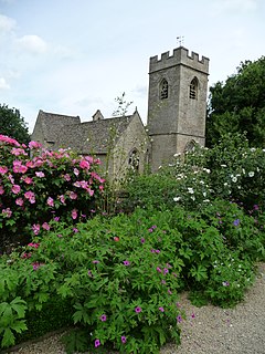
 St. Nicholas' parish church | |
Location within Oxfordshire | |
| Population | 252 (parish) (2011 Census) |
| OS grid reference | SP2811 |
| Civil parish |
|
| District | |
| Shire county | |
| Region | |
| Country | England |
| Sovereign state | United Kingdom |
| Post town | Burford |
| Postcode district | OX18 |
| Post town | Witney |
| Postcode district | OX29 |
| Dialling code | 01993 |
| Police | Thames Valley |
| Fire | Oxfordshire |
| Ambulance | South Central |
| UK Parliament | |
Asthall or Asthal is a village and civil parish on the River Windrush in the West Oxfordshire district, in Oxfordshire, about 6 miles (10 km) west of Witney. It includes the hamlets of Asthall Leigh, Field Assarts, Stonelands, Worsham and part of Fordwells. The 2011 Census recorded the parish's population as 252.[2] Asthall village is just south of the River Windrush, which also forms the south-eastern part of its boundary. The remainder of the parish including all of its hamlets lie north of the river. A minor road through Fordwells forms most of the parish's northern boundary. Most of the remainder of the parish's boundary is formed by field boundaries.
- ^ "Asthall Parish Council Website". Asthall Parish Council. Retrieved 6 July 2022.
- ^ "Area: Asthal (Parish): Key Figures for 2011 Census: Key Statistics". Neighbourhood Statistics. Office for National Statistics. Retrieved 24 March 2015.
