Atherton, California | |
|---|---|
| Town of Atherton | |
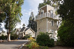
 Holbrook-Palmer Park | |
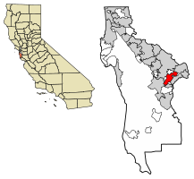
 Location of Atherton in San Mateo County, California | |
| Coordinates: 37°27′31″N 122°12′0″W / 37.45861°N 122.20000°W[1] | |
| Country | United States |
| State | California |
| County | San Mateo |
| Incorporated | September 12, 1923[2] |
| Named for | Faxon Dean Atherton[2] |
| Government | |
| • City council[5] |
|
| • Assemblymember | Alex Lee (D) (24th)[3] |
| • State Senator | Josh Becker (D) (13th)[3] |
| • U.S. Rep. | Anna Eshoo (D) (16th)[4] |
| Area | |
| • Total | 5.05 sq mi (13.07 km2) |
| • Land | 5.02 sq mi (12.99 km2) |
| • Water | 0.03 sq mi (0.08 km2) 0.63% |
| Elevation | 59 ft (18 m) |
| Population (2020) | |
| • Total | 7,188 |
| • Density | 1,433.01/sq mi (553.28/km2) |
| Time zone | UTC−8 (Pacific) |
| • Summer (DST) | UTC−7 (PDT) |
| ZIP Code[7] | 94027 |
| Area code[8] | 650 |
| FIPS code | 06-03092 |
| GNIS feature IDs | 1657960, 2411651 |
| Website | www |
Atherton (/ˈæθərtən/ ATH-ər-tən) is an incorporated town in San Mateo County, California, United States. Its population was 6,823 as of July 2023. The town's zoning regulations permit only one single-family home per acre, and prohibit sidewalks.[9]
Atherton is known for its wealth; in 1990 and 2019,[10] Atherton was ranked as having the highest per capita income among U.S. places that have a population between 2,500 and 9,999,[11] and the area covered by its ZIP Code is regularly ranked as having the highest cost of living in the United States.[12][13][14][15] In 2023, the Atherton ZIP Code had the highest median home prices in the United States, at $7,950,000.[16]
- ^ a b "Atherton". Geographic Names Information System. United States Geological Survey, United States Department of the Interior. Retrieved August 21, 2009.
- ^ a b "Atherton History". Town of Atherton. April 27, 2007. Archived from the original on September 12, 2009. Retrieved August 21, 2009.
- ^ a b "Statewide Database". UC Regents. Archived from the original on February 1, 2015. Retrieved December 29, 2014.
- ^ "California's 16th Congressional District - Representatives & District Map". Civic Impulse, LLC. Retrieved March 13, 2013.
- ^ "City Council". Town of Atherton. Retrieved December 29, 2014.
- ^ "2020 U.S. Gazetteer Files". United States Census Bureau. Retrieved October 30, 2021.
- ^ "USPS – ZIP Code Lookup – Search By City". United States Postal Service. Archived from the original on August 30, 2009. Retrieved August 21, 2009.
- ^ "NANP Administration System". North American Numbering Plan Administration. Archived from the original on September 22, 2010. Retrieved August 21, 2009.
- ^ Cite error: The named reference
Griffithwas invoked but never defined (see the help page). - ^ "These Are the Wealthiest Towns in the U.S." Bloomberg. Retrieved August 18, 2018.
- ^ Archive of "1990 CPH-L-126. Median Family Income for Places with a Population of 2,500 to 9,999, Ranked Within the United States: 1989", United States Census Bureau. 1990 CPH-L-126F.html Original page
- ^ Levy, Francesca (September 27, 2010). "America's Most Expensive ZIP Codes". Forbes.
- ^ Brennan, Morgan (October 16, 2013). "America's Most Expensive Zip Codes In 2013: The Complete List". Forbes. Archived from the original on October 19, 2013.
- ^ Sharf, Samantha (December 8, 2016). "Full List: America's Most Expensive ZIP Codes 2016". Forbes. Retrieved August 24, 2017.
- ^ SFGATE, Sam Moore (November 22, 2022). "Bay Area town named most expensive ZIP code for 6th year". SFGATE.
- ^ Kolomatsky, Michael (November 9, 2023). "America's Most Expensive ZIP Codes". The New York Times. Retrieved November 9, 2023.


