| Atrato River | |
|---|---|
 | |
 | |
| Location | |
| Country | Colombia |
| Physical characteristics | |
| Source | |
| • location | Colombia |
| Mouth | |
• location | Caribbean Sea, Colombia |
• coordinates | 8°10′45.2″N 76°56′28.7″W / 8.179222°N 76.941306°W |
| Length | 750 km (470 mi) |
| Basin size | 37,810 km2 (14,600 sq mi)[3] 35,996.7 km2 (13,898.4 sq mi)[2] |
| Discharge | |
| • location | Atrato Delta, Gulf of Urabá, Colombia |
| • average | 3,993 m3/s (141,000 cu ft/s)[1] 3,767.992 m3/s (133,065.4 cu ft/s)[2] |
| Basin features | |
| Tributaries | |
| • left | Truando |
| • right | Murrí, Sucio |

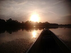
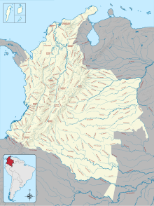
The Atrato River (Spanish: Río Atrato) is a river of northwestern Colombia. It rises in the slopes of the Western Cordillera and flows almost due north to the Gulf of Urabá (or Gulf of Darién), where it forms a large, swampy delta.[4] Its course crosses the Chocó Department, forming that department's border with neighboring Antioquia in two places. Its total length is about 650 km (400 mi), and it is navigable as far as Quibdó (400 km / 250 mi), the capital of the department.
In 2016, the Constitutional Court of Colombia granted the river legal rights of personhood after years of degradation of the river basin from large-scale mining and illegal logging practices, which severely impacted the traditional ways of life for Afro-Colombians and Indigenous people.
- ^ Félix Dario, Sánchez; Martha, García; Omar, Jaramillo; Nelsy, Verdugo (2010). "ESTUDIO NACIONAL DEL AGUA 2010 (IDEAM) - Agua Superficial - Caracterización y análísis de la oferta" (PDF).
- ^ a b "Rivers Network". 2020.
- ^ Félix Dario, Sánchez; Martha, García; Omar, Jaramillo; Nelsy, Verdugo (2010). "ESTUDIO NACIONAL DEL AGUA 2010 (IDEAM) - Agua Superficial - Caracterización y análísis de la oferta" (PDF).
- ^ One or more of the preceding sentences incorporates text from a publication now in the public domain: Chisholm, Hugh, ed. (1911). "Atrato". Encyclopædia Britannica. Vol. 2 (11th ed.). Cambridge University Press. p. 876.