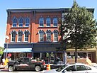
Augusta | |
|---|---|
| Motto: A Capital Opportunity[1] | |
 | |
| Coordinates: 44°18′38″N 69°46′46″W / 44.31056°N 69.77944°W | |
| Country | United States |
| Region | New England |
| State | Maine |
| County | Kennebec |
| Settled | 1754 |
| Incorporated (town) | February 20, 1797 |
| Incorporated (city) | August 20, 1849 |
| Village | North Augusta |
| Government | |
| • Mayor | Mark O'Brien[2] |
| Area | |
| • Total | 58.04 sq mi (150.31 km2) |
| • Land | 55.15 sq mi (142.83 km2) |
| • Water | 2.89 sq mi (7.48 km2) 5.00% |
| Elevation | 121 ft (37 m) |
| Population (2020) | |
| • Total | 18,899 |
| • Density | 342.70/sq mi (132.32/km2) |
| Time zone | UTC−5 (Eastern) |
| • Summer (DST) | UTC−4 (Eastern) |
| ZIP Codes | 04330, 04332-04333, 04336, 04338 |
| Area code | 207 |
| FIPS code | 23-02100 |
| GNIS feature ID | 581636 |
| Website | AugustaMaine.gov |
Augusta (/əˈɡʌstə/ ə-GUSS-tə) is the capital of the U.S. state of Maine and the county seat of and most populous city in Kennebec County. Augusta is included in the Lewiston-Auburn, Maine metropolitan New England city and town area. [5] The city's population was 18,899 at the 2020 census,[6] making it the 12th most populous city in Maine, and 3rd least populous state capital in the United States after Montpelier, Vermont, and Pierre, South Dakota.
The area was explored in 1607 by English settlers from the Popham Colony at the mouth of the Kennebec River.[7] Before European settlement, Algonquian-speaking Indians lived in the area.[7] In 1625, representatives of Plymouth Colony chose the east shore of the Kennebec for a trading post, which was likely built in 1628 and became known as "Cushnoc".[7] The Kennebec Proprietors, successors to the Plymouth Company, built Fort Western near the site of the abandoned trading post in 1754 and began settlement efforts.[7][8] The new village was incorporated as Hallowell in 1771, and the upriver part of town separated in 1797 to form the town of Harrington. On June 9, 1797, Harrington changed its name to Augusta and, in 1827, it was designated capital of Maine.[7]
Augusta is the easternmost state capital in the United States.[9] Located on the Kennebec River at the head of tide, it is the principal city in the Augusta-Waterville micropolitan statistical area and home to the University of Maine at Augusta.[10] Because of the city's position on the Kennebec, downtown Augusta is vulnerable to floods in spring.[11] The Maine flood of 1987, known as the "Great Flood", affected the city.[11] Bond Brook runs from northwest to southeast through the city center, and has been called the "Home of wild Atlantic Salmon".[11]
The city has five different residential areas, including the "west side", a historic neighborhood north of the state capitol complex, and the "east side", which is situated on the opposite side of the Kennebec.[12] The city's northwest quadrant includes both a retail center and neighborhoods.[12]
Augusta State Airport serves the city, offering both commercial service and general aviation.[11] Although the airport is owned by the State of Maine, it is managed and operated by the city.[11] Interstate 95 passes by the western outskirts of Augusta, and both U.S. 202 and U.S. 201 run through the city.
- ^ "City of Augusta, Maine". City of Augusta, Maine. Archived from the original on August 29, 2012. Retrieved August 26, 2012.
- ^ "Mark S. O'Brien". Augusta, ME. Archived from the original on September 11, 2019.
- ^ "2020 U.S. Gazetteer Files". census.gov. United States Census Bureau. Retrieved April 8, 2022.
- ^ "Geographic Names Information System". edits.nationalmap.gov. Retrieved May 5, 2023.
- ^ "Population and Population Centers by State". census.gov. United States Census Bureau. Archived from the original on December 12, 2001.
- ^ "Census - Geography Profile: Augusta city, Maine". United States Census Bureau. Retrieved January 8, 2022.
- ^ a b c d e "Welcome to Augusta , ME". augustamaine.gov. City of Augusta, Maine. Archived from the original on July 11, 2023. Retrieved July 11, 2023.
- ^ Snell, Charles (1972). "National Register of Historic Places Inventory-Nomination: Fort Western" (PDF). National Park Service. Retrieved June 22, 2009. and Accompanying two photos, exterior, from 1971 (484 KB)
- ^ "Augusta". State Symbols USA. February 10, 2015. Retrieved July 11, 2023.
- ^ Cite error: The named reference
:1was invoked but never defined (see the help page). - ^ a b c d e "Augusta". Maine: An Encyclopedia. March 14, 2011. Retrieved July 11, 2023.
- ^ a b "Neighborhood Revitalization". City of Augusta, Maine. Archived from the original on February 10, 2020. Retrieved July 11, 2023.


