Austevoll Municipality
Austevoll kommune | |
|---|---|
| Austevold herred (historic name) Østervold herred (historic name) | |
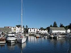
 Bekkjarvik harbour | |
|
| |
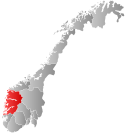
 Vestland within Norway | |
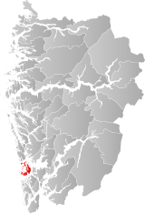
 Austevoll within Vestland | |
| Coordinates: 60°02′16″N 05°16′06″E / 60.03778°N 5.26833°E | |
| Country | Norway |
| County | Vestland |
| District | Midhordland |
| Established | 1 Jan 1886 |
| • Preceded by | Sund Municipality |
| Administrative centre | Storebø |
| Government | |
| • Mayor (2023) | Bente Kari Sletten Taranger (H) |
| Area | |
| • Total | 117.22 km2 (45.26 sq mi) |
| • Land | 114.27 km2 (44.12 sq mi) |
| • Water | 2.95 km2 (1.14 sq mi) 2.5% |
| • Rank | #323 in Norway |
| Population (2023) | |
| • Total | 5,297 |
| • Rank | #177 in Norway |
| • Density | 46.4/km2 (120/sq mi) |
| • Change (10 years) | |
| Demonym | Austevolling[1] |
| Official language | |
| • Norwegian form | Nynorsk |
| Time zone | UTC+01:00 (CET) |
| • Summer (DST) | UTC+02:00 (CEST) |
| ISO 3166 code | NO-4625[3] |
| Website | Official website |
Austevoll is a municipality and an archipelago in Vestland county, Norway. It is located in the traditional district of Midthordland in Western Norway. The administrative centre is the village of Storebø on the island of Huftarøy. Other villages include Årland, Austevollshella, Bakkasund, Bekkjarvik, Birkeland, Haukanes, Husavik, Kolbeinsvik, Otterå, Våge, and Vinnes.
The municipality consists of hundreds of islands located southwest of the city of Bergen. The municipality is considered to be among the ports in the world with the largest ocean-going fishing trawler fleet. Since the 1980s, the offshore oil industry and fish farming industry have both grown to be important industries in Austevoll.
The 117-square-kilometre (45 sq mi) municipality is the 323rd largest by area out of the 356 municipalities in Norway. Austevoll is the 177th most populous municipality in Norway with a population of 5,297. The municipality's population density is 46.4 inhabitants per square kilometre (120/sq mi) and its population has increased by 9.5% over the previous 10-year period.[4][5]
- ^ "Navn på steder og personer: Innbyggjarnamn" (in Norwegian). Språkrådet.
- ^ "Forskrift om målvedtak i kommunar og fylkeskommunar" (in Norwegian). Lovdata.no.
- ^ Bolstad, Erik; Thorsnæs, Geir, eds. (26 January 2023). "Kommunenummer". Store norske leksikon (in Norwegian). Kunnskapsforlaget.
- ^ Statistisk sentralbyrå. "Table: 06913: Population 1 January and population changes during the calendar year (M)" (in Norwegian).
- ^ Statistisk sentralbyrå. "09280: Area of land and fresh water (km²) (M)" (in Norwegian).

