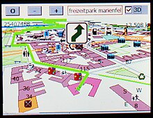
An automotive navigation system is part of the automobile controls or a third party add-on used to find direction in an automobile. It typically uses a satellite navigation device to get its position data which is then correlated to a position on a road. When directions are needed routing can be calculated. On the fly traffic information (road closures, congestion) can be used to adjust the route.
Dead reckoning using distance data from sensors attached to the drivetrain, an accelerometer, a gyroscope, and a magnetometer can be used for greater reliability, as GNSS signal loss and/or multipath can occur due to urban canyons or tunnels.
Mathematically, automotive navigation is based on the shortest path problem, within graph theory, which examines how to identify the path that best meets some criteria (shortest, cheapest, fastest, etc.) between two points in a large network.
Automotive navigation systems are crucial for the development of self-driving cars.[1]
- ^ Zhao, Jianfeng; Liang, Bodong; Chen, Qiuxia (2018-01-02). "The key technology toward the self-driving car". International Journal of Intelligent Unmanned Systems. 6 (1): 2–20. doi:10.1108/IJIUS-08-2017-0008. ISSN 2049-6427.