This article needs additional citations for verification. (January 2018) |
| Autopista A1 | |
|---|---|
| Autopista Nacional | |
| National Motorway | |
 Map of the Cuban motorway network | |
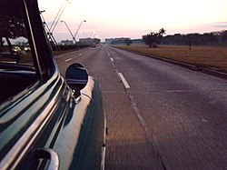
 View of the A1 in Havana | |
| Route information | |
| Length | 900 km (560 mi) |
| Existed | 1979–present |
| Major junctions | |
| West end | Calle Central / Avenida Ciudamar (Havana) |
Majá–Taguasco Road (to 6–371 Santiago Beltway | |
| East end | 6–571 / West Beltway (Guantanamo) |
| Location | |
| Country | Cuba |
| Major cities | Havana, San José de las Lajas, Güines, Jagüey Grande, Aguada de Pasajeros, Santa Clara, Placetas, Cabaiguán, Sancti Spíritus, Jatibonico, Ciego de Ávila, Florida, Camagüey, Guáimaro, Las Tunas, Holguín, Bayamo,[1] Contramaestre, Palma Soriano, San Luis, Santiago de Cuba, La Maya, Guantánamo |
| Highway system | |
The Autopista A1, also known as Autopista Nacional, is a Cuban motorway, partly built, that will link Havana to Guantánamo.[2] It is a toll-free road and its total length will be of about 900 km (560 mi). Along with the Autopista A4, linking Havana to Pinar del Río, it is classified as part of the whole Autopista Nacional route, spanning the length of the island; as the Carretera Central highway.
