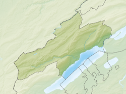
Auvernier | |
|---|---|
 Auvernier village | |
| Coordinates: 46°59′N 6°53′E / 46.983°N 6.883°E | |
| Country | Switzerland |
| Canton | Neuchâtel |
| District | Boudry |
| Municipality | Milvignes |
| Area | |
| • Total | 1.69 km2 (0.65 sq mi) |
| Elevation | 433 m (1,421 ft) |
| Population (31 December 2018)[1] | |
| • Total | 1,559 |
| • Density | 920/km2 (2,400/sq mi) |
| Time zone | UTC+01:00 (Central European Time) |
| • Summer (DST) | UTC+02:00 (Central European Summer Time) |
| Postal code(s) | 2012 |
| SFOS number | 6401 |
| ISO 3166 code | CH-NE |
| Surrounded by | Colombier, Corcelles-Cormondrèche, Neuchâtel, Peseux |
| Website | www SFSO statistics |
Auvernier is a village in the district of Boudry in the canton of Neuchâtel in Switzerland. The municipalities of Auvernier, Bôle and Colombier merged on 1 January 2013 into the new municipality of Milvignes.[2]
- ^ https://www.pxweb.bfs.admin.ch/pxweb/fr/px-x-0103010000_101/-/px-x-0103010000_101.px.
{{cite web}}: Missing or empty|title=(help) - ^ Amtliches Gemeindeverzeichnis der Schweiz published by the Swiss Federal Statistical Office (in German) accessed 2 January 2013


