| Awatere River | |
|---|---|
 | |
 | |
| Etymology | translation of "swift river" |
| Native name | Awatere (Māori) |
| Location | |
| Country | New Zealand |
| Region | Marlborough |
| Physical characteristics | |
| Mouth | |
• location | Cook Strait |
• coordinates | 41°36′29″S 174°10′01″E / 41.608°S 174.167°E |
| Length | 110 km (68 mi) |
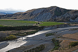
The Awatere River is a large river flowing through Marlborough, New Zealand. Flowing along the trace of the active Awatere Fault, it runs northeast through a straight valley to the west of the Inland Kaikōura mountains. This valley is parallel with that of the Waiau Toa / Clarence River, 20 kilometres (12 mi) to the south.
It flows for 110 kilometres (68 mi) from its source in the mountainous interior to reach Cook Strait close to the town of Seddon.
The New Zealand Ministry for Culture and Heritage gives a translation of "swift river" for Awatere in Māori.[1]
- ^ "1000 Māori place names". New Zealand Ministry for Culture and Heritage. 6 August 2019.