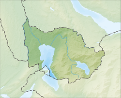
Baar | |
|---|---|
 | |
| Coordinates: 47°12′N 8°31′E / 47.200°N 8.517°E | |
| Country | Switzerland |
| Canton | Zug |
| District | n.a. |
| Government | |
| • Executive | Gemeinderat with 7 members |
| • Mayor | Gemeindepräsident (list) Andreas Hotz (as of March 2014) |
| Area | |
| • Total | 24.83 km2 (9.59 sq mi) |
| Elevation | 443 m (1,453 ft) |
| Population (31 December 2018)[2] | |
| • Total | 24,464 |
| • Density | 990/km2 (2,600/sq mi) |
| Time zone | UTC+01:00 (Central European Time) |
| • Summer (DST) | UTC+02:00 (Central European Summer Time) |
| Postal code(s) | 6340, 6342 |
| SFOS number | 1701 |
| ISO 3166 code | CH-ZG |
| Localities | Allenwinden, Blickensdorf, Deinikon, Inwil bei Baar, Neuägeri, Sihlbrugg Dorf, Walterswil |
| Surrounded by | Hausen am Albis (ZH), Kappel am Albis (ZH), Menzingen, Neuheim, Steinhausen, Unterägeri, Zug |
| Website | www SFSO statistics |
Baar (German pronunciation: [baːr]) is a municipality in the canton of Zug in Switzerland.
- ^ a b "Arealstatistik Standard - Gemeinden nach 4 Hauptbereichen". Federal Statistical Office. Retrieved 13 January 2019.
- ^ "Ständige Wohnbevölkerung nach Staatsangehörigkeitskategorie Geschlecht und Gemeinde; Provisorische Jahresergebnisse; 2018". Federal Statistical Office. 9 April 2019. Retrieved 11 April 2019.


