| Babinda Cairns, Queensland | |||||||||||||||
|---|---|---|---|---|---|---|---|---|---|---|---|---|---|---|---|
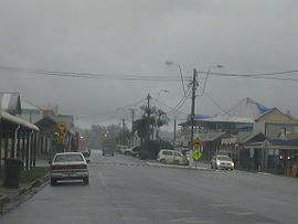
 Babinda on a typical rainy day | |||||||||||||||
 | |||||||||||||||
| Coordinates | 17°20′38″S 145°55′17″E / 17.34389°S 145.92139°E | ||||||||||||||
| Population | 1,113 (UCL 2021)[1] | ||||||||||||||
| Established | circa 1880 - circa 1900 | ||||||||||||||
| Postcode(s) | 4861 | ||||||||||||||
| Elevation | 18.3 m (60 ft) | ||||||||||||||
| Area | 39.9 km2 (15.4 sq mi) | ||||||||||||||
| Time zone | AEST (UTC+10:00) | ||||||||||||||
| Location |
| ||||||||||||||
| LGA(s) | Cairns Region | ||||||||||||||
| State electorate(s) | Hill | ||||||||||||||
| Federal division(s) | Kennedy | ||||||||||||||
| |||||||||||||||
| |||||||||||||||
Babinda is a rural town and locality in the Cairns Region, Queensland, Australia.[2][3] Babinda and Tully annually compete for the Golden Gumboot, an award for Australia's wettest town. Babinda is usually the winner, recording an annual average rainfall of over 4,279.4 millimetres (168.48 in) each year.[4] In the 2021 census, the locality of Babinda had a population of 1,287 people.[5]
Babinda is located south of Cairns and was known for historically being a “sugar town”.
- ^ Australian Bureau of Statistics (28 June 2022). "Babinda (urban centre and locality)". Australian Census 2021.
- ^ "Babinda – town in Cairns Region (entry 1081)". Queensland Place Names. Queensland Government. Retrieved 26 December 2020.
- ^ "Babinda – locality in Cairns Region (entry 48502)". Queensland Place Names. Queensland Government. Retrieved 26 December 2020.
- ^ Geiger, Dominic (14 December 2016). "Bets on Babinda in race to record rainfall gold". Mackay Mercury. Archived from the original on 18 August 2021. Retrieved 6 May 2017.
- ^ Cite error: The named reference
Census2021was invoked but never defined (see the help page).
