Baby Point | |
|---|---|
Neighbourhood | |
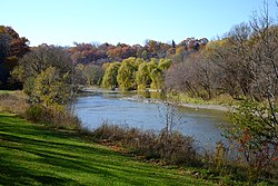
 The Humber River at Magwood Park, a park that surrounds the northwest portions of Baby Point | |
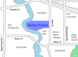
 Vicinity of Baby Point | |
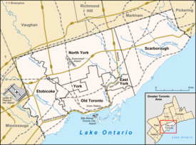
| Coordinates: 43°39′27″N 79°29′33″W / 43.65750°N 79.49250°W | |
| Country | |
| Province | |
| City | Toronto |
| Settled | 1816 |
| Changed Municipality | 1998 Toronto from York |
| Government | |
| • MP | Arif Virani (Parkdale—High Park) |
| • MPP | Bhutila Karpoche (Parkdale—High Park) |
| • Councillor | Gord Perks (Ward 4 Parkdale—High Park) |
Baby Point is a residential neighbourhood in Toronto, Ontario, Canada. It is bounded on the west by the Humber River from south of Baby Point Crescent to St. Marks Road, east to Jane Street and Jane Street south to Raymond Avenue and Raymond Avenue west to the Humber. It is within the city-defined neighbourhood of 'Lambton-Baby Point'. Baby Point is within the proximity of Jane station.
The neighbourhood was at one time an Iroquois village, called Teiaiagon. The village had a population of 5000 at its peak. In the 19th century, lawyer James Baby bought the land from the Upper Canada government, which had bought it as part of the Toronto Purchase. The land was developed into the current neighbourhood in the early 20th century as part of York Township. The name is pronounced by locals as "Bobby" or "Babby"—to rhyme with tabby or cabbie—in an approximation of how James Baby pronounced his surname.
