| Backbone State Park | |
|---|---|
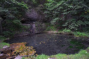
 Richmond Springs | |
| Coordinates | 42°37′59″N 91°33′42″W / 42.63306°N 91.56167°W |
| Area | 2,001 acres (8.10 km2) |
| Established | 1919 |
| Governing body | Iowa Department of Natural Resources |
| Website | Backbone State Park |
Backbone State Park Historic District | |
| Area | 1,415 acres (573 ha) |
| Built | 1933-1942 |
| Architect | John R. Fitzsimmons |
| Architectural style | Rustic |
| MPS | CCC Properties in Iowa State Parks MPS |
| NRHP reference No. | 91001842[1] |
| Added to NRHP | December 23, 1991 |
Backbone State Park is Iowa's oldest state park, dedicated in 1919. Located in the valley of the Maquoketa River, it is approximately three miles (5 km) south of Strawberry Point in Delaware County. It is named for a narrow and steep ridge of bedrock carved by a loop of the Maquoketa River originally known as the Devil's Backbone. The initial 1,200 acres (490 ha) were donated by E.M. Carr of Lamont, Iowa. Backbone Lake Dam, a relatively low dam built by the Civilian Conservation Corps (CCC) in the 1930s, created Backbone Lake. The CCC constructed a majority of trails and buildings which make up the park.
