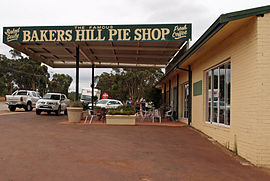
| Bakers Hill Western Australia | |||||||||
|---|---|---|---|---|---|---|---|---|---|
 Bakers Hill | |||||||||
 | |||||||||
| Coordinates | 31°45′04″S 116°27′18″E / 31.751°S 116.455°E | ||||||||
| Population | 792 (UCL 2021)[1] | ||||||||
| Established | 1897 | ||||||||
| Postcode(s) | 6562 | ||||||||
| Elevation | 330 m (1,083 ft) | ||||||||
| Area | 83.9 km2 (32.4 sq mi) | ||||||||
| Location | |||||||||
| LGA(s) | Shire of Northam | ||||||||
| State electorate(s) | Central Wheatbelt | ||||||||
| Federal division(s) | Pearce | ||||||||
| |||||||||
Bakers Hill is a town 73 kilometres (45 mi) east of Perth, Western Australia on the Great Eastern Highway. The town is located within the Shire of Northam, between Wundowie and Clackline. At the 2021 census, Bakers Hill had a population of 1276.
- ^ Australian Bureau of Statistics (28 June 2022). "Bakers Hill (urban centre and locality)". Australian Census 2021.
