Bakshi Ka Talab
Bakshi, BKT, Afs | |
|---|---|
Residential area | |
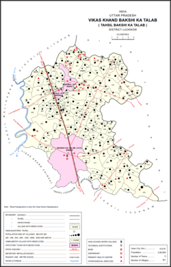
 Map of Bakshi Ka Talab CD block | |
| Coordinates: 26°59′0″N 80°53′0″E / 26.98333°N 80.88333°E | |
| Country | |
| State | Uttar Pradesh |
| District | Lucknow |
| Area | |
| • Total | 41.9 km2 (16.2 sq mi) |
| Elevation | 124 m (407 ft) |
| Population (2011)[1] | |
| • Total | 49,166 |
| • Density | 1,200/km2 (3,000/sq mi) |
| Languages | |
| • Official | Hindi |
| Time zone | UTC+5:30 (IST) |
| PIN | 226201 |
| Vehicle registration | UP-32 |
| Coastline | 0 kilometres (0 mi) |
| Nearest city | Lucknow |
| Lok Sabha constituency 169 | 0 |
Bakshi Ka Talab is a nagar panchayat town in Lucknow district of Uttar Pradesh, India.[1] It is also the headquarters of a corresponding tehsil, as well as a community development block of the same name.[1] As of 2011, its population was 49,166, in 8,728 households.[1] It consists of both residential and business settlements. Bakshi Ka Talab is an organised settlement developed by Lucknow Development Authority (LDA). It is connected to Lucknow via National Highway 24.[2]
Bakshi Ka Talab features the annual play Ramlila, staged since 1972, wherein lead characters like Rama, Lakshamana and Hanumana are played by Muslim youths. This play has also been adapted into radio play "Us gaon ki ramlila" to promote communal harmony among the masses.[3]
The three main commodities produced here are cement tiles and pipes, soap, and furniture.[1] The famous Chandrika Devi Temple is located in nearby Kathwara.[citation needed]
- ^ a b c d e f "Census of India 2011: Uttar Pradesh District Census Handbook - Lucknow, Part A (Village and Town Directory)". Census 2011 India. pp. xii, 6, 28–67, 112–37, 278–292. Retrieved 11 March 2021.
- ^ Start and end points of National Highways Archived 10 April 2009 at the Library of Congress Web Archives
- ^ Indian art and Culture by Nitin Singhania 2nd edition
