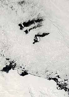
 Map of the Balleny Islands | |
| Geography | |
|---|---|
| Location | Antarctica |
| Coordinates | 66°55′S 163°45′E / 66.917°S 163.750°E |
| Archipelago | Balleny Islands |
| Area | 800 km2 (310 sq mi) |
| Highest elevation | 1,705 m (5594 ft) |
| Highest point | Brown Peak[1][2] |
| Administration | |
| Administered under the Antarctic Treaty System | |
| Demographics | |
| Population | Uninhabited |

The Balleny Islands (66°55′S 163°45′E / 66.917°S 163.750°E) are a series of uninhabited islands in the Southern Ocean extending from 66°15' to 67°35'S and 162°30' to 165°00'E. The group extends for about 160 km (99 mi) in a northwest-southeast direction. The islands are heavily glaciated and of volcanic origin. Glaciers project from their slopes into the sea. The islands were formed by the so-called Balleny hotspot.
The group includes three main islands: Young, Buckle and Sturge, which lie in a line from northwest to southeast, and several smaller islets and rocks:
- northeast of Young Island: Seal Rocks, Pillar
- southeast of Young Island: Row Island, Borradaile Island (with Swan Base shelter hut)
- south of Buckle Island: Scott Cone, Chinstrap Islet, Sabrina Islet (with Sabrina Refuge shelter hut), and the Monolith
The islands are claimed by New Zealand as part of the Ross Dependency (see Territorial claims in Antarctica).
