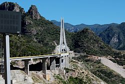
Baluarte Bridge Puente Baluarte | |
|---|---|
 Baluarte Bridge shortly after completion, 10 March 2012 | |
| Coordinates | 23°32′03″N 105°45′46″W / 23.53417°N 105.76278°W |
| Carries | 4 lanes of |
| Crosses | Baluarte River |
| Locale | Concordia in Sinaloa and Pueblo Nuevo in Durango, Mexico |
| Official name | Puente Baluarte Bicentenario |
| Characteristics | |
| Design | Cable-stayed bridge |
| Material | Prestressed concrete |
| Total length | 1,124 m (3,688 ft) |
| Width | 19.8 m (65 ft) |
| Longest span | 520 m (1,710 ft) |
| Clearance below | 403 m (1,322 ft) |
| History | |
| Construction start | 21 February 2008 |
| Construction end | (inaugurated) 5 January 2012 |
| Opened | late 2013 |
| Location | |
 | |
The Baluarte Bridge (Spanish: Puente Baluarte), officially the Baluarte Bicentennial Bridge (Spanish: Puente Baluarte Bicentenario),[1] is a cable-stayed bridge in Mexico. It is located between the municipalities of Concordia in Sinaloa and Pueblo Nuevo in Durango, along the Durango–Mazatlán highway, Mexico 40D. The bridge has a total length of 1,124 m (3,688 ft),[2] with a central cable-stayed span of 520 m (1,710 ft).[3] With the road deck at 403 m (1,322 ft)[2] above the valley below, the Baluarte Bridge is the third-highest cable-stayed bridge in the world, the eighth-highest bridge overall, and the highest bridge in the Americas.[4]
Construction of the bridge began in 2008, it was inaugurated in January 2012 and opened to traffic in late 2013.[5] The bridge forms part of a new highway linking the Atlantic and Pacific coasts of northern Mexico and has reduced the travelling time between Durango and Mazatlán from approximately 6 to 2.5 hours.[2]
- ^ "Supervisión de obra del Puente Baluarte Bicentenario" (in Spanish). President of the Republic. 5 January 2012. Retrieved 7 January 2012.
- ^ a b c Cite error: The named reference
bbcwas invoked but never defined (see the help page). - ^ "Mexico Receives Guinness Record For Highest Suspension Bridge". Fox News Latino. 6 January 2012. Archived from the original on 17 March 2013. Retrieved 7 January 2012.
- ^ Cite error: The named reference
Hawleywas invoked but never defined (see the help page). - ^ "Baluarte Bridge Open, Slashes Journey Times". Mexperience. December 17, 2013. Retrieved 17 July 2014.