| Balygychan Балыгычан | |
|---|---|
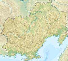
Mouth location in Magadan Oblast, Russia | |
| Location | |
| Country | Magadan Oblast, Russia |
| Physical characteristics | |
| Source | |
| • location | Hal-Urekchen, Kolyma Mountains |
| • coordinates | 61°41′36″N 155°26′48″E / 61.69333°N 155.44667°E |
| Mouth | Kolyma |
• coordinates | 63°59′13″N 154°14′40″E / 63.98694°N 154.24444°E |
• elevation | 126 m (413 ft) |
| Length | 400 km (250 mi) |
| Basin size | 17,600 km2 (6,800 sq mi) |
| Basin features | |
| Progression | Kolyma→ East Siberian Sea |
The Balygychan (Russian: Балыгычан) is a river in Magadan Oblast, Russian Far East. It is 352 kilometres (219 mi) long (400 km including Levy Balygychan), with a drainage basin of 17,600 square kilometres (6,800 sq mi).[1]
The river freezes in October and stays frozen until the end of May.[2] Graylings, longnose suckers, pikes and whitefish are common in the Balygychan waters.[3]
- ^ Russian State Water Register - Balygychan
- ^ Балыгычан Great Soviet Encyclopedia in 30 vols. / Ch. ed. A.M. Prokhorov - 3rd ed. - M, 1969-1978. (in Russian)
- ^ Water - Balygychan (in Russian)
