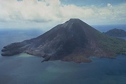
 Banda Api | |
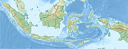
 Map of Banda Islands | |
| Geography | |
|---|---|
| Location | Banda Sea |
| Coordinates | 4°31′30″S 129°52′17″E / 4.52500°S 129.87139°E |
| Archipelago | Banda Islands |
| Length | 3 km (1.9 mi) |
| Width | 3 km (1.9 mi) |
| Highest elevation | 640 m (2100 ft) |
| Highest point | Gunung Api |

Banda Api (Indonesian api, fire) is an island in the Banda Islands, Indonesia.[1] It is administered as part of the administrative district (kecamatan) within the Central Maluku Regency in the province of Maluku.
- ^ Cribb, Robert (2013-02-01). Historical Atlas of Indonesia. Routledge. p. 109. ISBN 9781136780578.
