Bangarmau
Bangermau | |
|---|---|
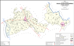
 Map of Bangarmau CD block | |
| Coordinates: 26°54′N 80°13′E / 26.9°N 80.22°E | |
| Country | |
| State | Uttar Pradesh |
| District | Unnao |
| Area | |
| • Total | 18.5 km2 (7.1 sq mi) |
| Elevation | 122 m (400 ft) |
| Population (2011)[1] | |
| • Total | 44,204 |
| • Density | 2,400/km2 (6,200/sq mi) |
| Languages | |
| • Official | Hindi |
| • Spoken | Kannauji Khadi Boli English |
| Time zone | UTC+5:30 (IST) |
| Vehicle registration | UP-35 |
Bangarmau is a tehsil and a municipal board in Unnao district in the state of Uttar Pradesh, India.[1] It is located on high ground overlooking the left bank of the Kalyani river,[2] about 50 km northwest of Unnao and 22 km northwest of Safipur.[1] Roads fan out in all directions from Bangarmau, including the main Unnao-Hardoi road SH38 that passes through town.[2] Major commodities produced here include wheat flour, rice, and pulses.[1] As of 2011, the population of Bangarmau is 44,204, in 7,600 households.[1]
Near Bangarmau is Sanchan Kot, where in 2009, an Archaeological Survey of India excavation unearthed a 2000-year-old Shiva temple.[3]
- ^ a b c d e f "Census of India 2011: Uttar Pradesh District Census Handbook - Unnao, Part A (Village and Town Directory)". Census 2011 India. pp. 36–55, 93–109, 525–39. Retrieved 28 June 2021.
- ^ a b Nevill, H.R. (1903). Unao: A Gazetteer, Being Volume XXXVIII Of The District Gazetteers Of The United Provinces Of Agra And Oudh. Allahabad: Government Press. pp. 156–60. Retrieved 28 June 2021.
- ^ Sharda, Shailvee (23 February 2009). "2000-yr-old Shiva shrine found". The Times of India. Retrieved 16 December 2019.
