| Bantam Lake | |
|---|---|
 Bantam Lake | |
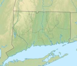
| Location | Border of Morris, Connecticut and Litchfield, Connecticut |
| Coordinates | 41°42′16″N 73°13′17″W / 41.7045073°N 73.2215068°W [1] |
| Type | Lake |
| Primary inflows | Bantam River |
| Primary outflows | Bantam River |
| Max. length | 2.32 miles (3.73 km) |
| Max. width | 1.47 miles (2.37 km) |
| Surface area | 947 acres (383 ha)[2][3] |
| Average depth | 14.3 feet (4.4 m)[4] |
| Max. depth | 25 feet (7.6 m)[4] |
| Residence time | 108 days[4] |
| Surface elevation | 892 feet (272 m)[1] |
| Islands | Deer Island |
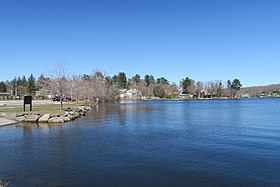
Bantam Lake is the largest natural lake in Connecticut, covering 947 acres (383 ha) in the towns of Morris and Litchfield. Much of the land at the northern end of the lake, including the peninsula of Marsh Point, is protected by the White Memorial Foundation and home to a wide array of bird species.[5] It is lined by campgrounds,[6] camps for kids and has facilities for various water sports.[7] The lake also has two public beaches, Morris Town Beach[8] and Sandy Beach.[7]
It is home to the Bantam Lake Ski Club,[9] the oldest, continuously operating water ski club in the United States, as well as the Litchfield Hills Rowing Club[10] which offers Summer and Fall (high school) and Masters programs.
- ^ a b "Bantam Lake". Geographic Names Information System. United States Geological Survey, United States Department of the Interior.
- ^ Cite error: The named reference
bathymetrywas invoked but never defined (see the help page). - ^ Cite error: The named reference
launchwas invoked but never defined (see the help page). - ^ a b c Cite error: The named reference
qualitywas invoked but never defined (see the help page). - ^ "Bantam Lake". Connecticut Office of Tourism. 19 May 2014. Retrieved 15 September 2014.
- ^ "White Memorial Foundation Family Campgrounds". White Memorial Conservation Center, Inc. Archived from the original on 29 August 2014. Retrieved 15 September 2014.
- ^ a b "Bantam Lake Protective Association – Connecticut's Largest Natural Lake". bantamlakect.com. Retrieved 2016-09-15.
- ^ "Town of Morris Connecticut". www.townofmorrisct.com. Archived from the original on 2016-09-18. Retrieved 2016-09-15.
- ^ "Bantam Lake Ski Club". bantamlakeskiclub.com. Archived from the original on 2023-08-20. Retrieved 2022-06-25.
- ^ "Litchfield Hills Rowing Club | on Bantam Lake, Connecticut". Archived from the original on 2015-03-08. Retrieved 2022-06-25.
