Bara District
बारा जिल्ला | |
|---|---|
|
Lal Bakaiya river, Kalaiya clock tower, a paddy field in Simara, remains of Simraungadh Fort (Clockwise from top) | |
| Nickname: अन्नको
भण्डार | |
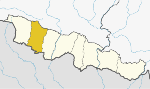
 Bara District (dark yellow) in Madhesh Province | |
| Country | |
| Province | Madhesh |
| Admin HQ. | Kalaiya |
| Government | |
| • Type | Coordination committee |
| • Body | DCC, Bara |
| Area | |
| • Total | 1,190 km2 (460 sq mi) |
| Population (2021)[1] | |
| • Total | 743,982 |
| • Density | 630/km2 (1,600/sq mi) |
| Time zone | UTC+05:45 (NPT) |
| Main Languages | Bhojpuri, Nēpālī, Tharu, Maithili |
| Website | ddcbara |
Bara District (Nepali: बारा जिल्ला ) is one of the seventy–seven districts of Nepal, located in the western part of the Madhesh Province. The district is third richest district in Nepal after Kathmandu and Morang with 3.3% share of total GDP of Nepal and highest per capita income in Madhesh province. Kalaiya serves as the district's headquarter. Bakaiya, Jamuniya, Pasaha, Dudhaura and Bangari are the main rivers of Bara. The main languages spoken in the district are Bhojpuri, Tharu, Bajjika, and Nepali.[3]
- ^ "National Population and Housing Census 2021(National Report)". Central Bureau of Statistics. Government of Nepal. November 2021.
- ^ "Visualizing Development". National Planning Commission.
- ^ "Top 10 languages spoken as mother tongues in Nepal". Code for Nepal. 2014-02-28. Retrieved 2019-01-02.


