Barguna
বরগুনা | |
|---|---|
| Barguna District | |
|
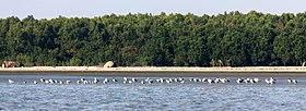
From top: Seabirds in Barguna Coastal area (Laldia beach), Tengragiri Wildlife Sanctuary, Bibicini Shahi Mosque, Haringhata Reserved Forest, Ashar Chor and Bibicini Shahi Mosque | |
 Location in Bangladesh | |
 Expandable map of Barguna District | |
| Coordinates: 22°09′03″N 90°07′35″E / 22.1508°N 90.1264°E | |
| Country | |
| Division | Barisal Division |
| Headquarters | Barguna |
| Government | |
| • Deputy Commissioner | Mustain Billah |
| • District Council Chairman | Md. Delwar Hossein [1] |
| • Chief Executive Officer | Md. Owahedur Rahman |
| Area | |
| • Total | 1,831.31 km2 (707.07 sq mi) |
| Elevation | 3 m (10 ft) |
| Highest elevation | 27 m (89 ft) |
| Lowest elevation | −3 m (−10 ft) |
| Population | |
| • Total | 1,010,531 |
| • Density | 550/km2 (1,400/sq mi) |
| • Male | 494,738 [3] |
| • Female | 515,723 [3] |
| Time zone | UTC+06:00 (BST) |
| Postal code | 8700 |
| Area code | 0448[4] |
| ISO 3166 code | BD-02 |
| HDI (2018) | 0.586[5] medium · 16th of 21 |
Barguna (Bengali: বরগুনা Borguna) is a district in the division of Barisal, in southern Bangladesh.[6] Barguna subdivision was established in 1969 and promoted to a district on 28 February 1984.
- ^ zp.barguna.gov.bd
- ^ a b c "Barguna District topographic map". topographic-map.com. Retrieved October 3, 2024.
- ^ a b c Cite error: The named reference
2022censuswas invoked but never defined (see the help page). - ^ "Bangladesh Area Code". China: Chahaoba.com. 18 October 2024.
- ^ "Sub-national HDI - Area Database - Global Data Lab". hdi.globaldatalab.org. Retrieved 2020-03-18.
- ^ Md Monir Hossain Kamal (2012). "Barguna District". In Sirajul Islam and Ahmed A. Jamal (ed.). Banglapedia: National Encyclopedia of Bangladesh (Second ed.). Asiatic Society of Bangladesh.


