This article needs additional citations for verification. (June 2011) |
| Baruntse | |
|---|---|
 Baruntse from Hongu Valley | |
| Highest point | |
| Elevation | 7,162 m (23,497 ft)[1] |
| Prominence | 979 m (3,212 ft)[1] |
| Coordinates | 27°52′18″N 86°58′48″E / 27.87167°N 86.98000°E |
| Geography | |
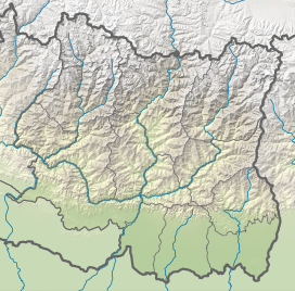
| Location | Khumbu, Nepal |
| Parent range | Himalayas |
| Climbing | |
| First ascent | 1954 by New Zealand expedition |
| Easiest route | glacier/snow/ice climb |
Baruntse is a mountain in the Khumbu region of eastern Nepal, crowned by four peaks and bounded on the south by the Hunku Glacier, on the east by the Barun Glacier, and on the northwest by the Imja Glacier. It is considered as one of the best preparation peaks in the Himalayas for climbers readying themselves for eight-thousanders, however the mountain has a low success rate due to its technical difficulties, steep slopes and unpredictable weather conditions.[2] It is open for beginners, but requires the use of fixed ropes to climb.[3]
Accessing the mountain is usually gained from the South, where climbers can ascend Mera Peak to acclimatize before moving up the valley to Baruntse base camp. From the village of Lukla, it is an eight day hike to base camp.[4]
- ^ a b "Baruntse, Nepal" Peakbagger.com. Retrieved 2012-01-22.
- ^ "Three climbers scale Mt Baruntse with Seven Summit Treks". The Himalayan Times. 2023-11-03. Retrieved 2024-06-27.
- ^ Callaghan, Anna (2019-03-03). "The First Canine Ascent of a 7,000-Meter Himalayan Peak". Outside Online. Retrieved 2024-06-27.
- ^ Efimov, Sergei (1995). "AAC Publications - Baruntse, West Face, Historical Ascent". publications.americanalpineclub.org. Retrieved 2024-06-27.

