Batoche | |
|---|---|
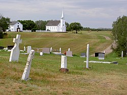
 Church, rectory and cemetery of Saint Antoine de Padoue in Batoche | |
| Coordinates: 52°45′18″N 106°06′58″W / 52.755°N 106.116°W | |
| Country | Canada |
| Province | Saskatchewan |
| Region | Southcentral Saskatchewan |
| Census division | 15 |
| Rural Municipality | St. Louis No. 431 |
| Established | 1872 |
| Incorporated (village) | 1885 |
| Designation (National Historic Site) | 1923 |
| Government | |
| • administrator | Louise Hodgson |
| • Governing body | St. Louis No. 431 |
| Time zone | CST |
| Postal code | S0J 1E0 |
| Area code | 306 |
| Highways | Highway 225 |
| Waterways | South Saskatchewan River |
| Official name | Batoche National Historic Site of Canada |
| Designated | 1923 |
| [1][2][3] | |
Batoche, Saskatchewan, which lies between Prince Albert and Saskatoon, was the site of the historic Battle of Batoche during the North-West Rebellion of 1885. The battle resulted in the defeat of Louis Riel and his Métis forces by Major General Frederick Middleton and his Northwest Field Force. Batoche was then a small village of some 500 residents. The site has since become depopulated and now has few residents. The 1885 church building and a few other historic buildings have been preserved, and the site is a National Historic Site.
- ^ National Archives, Archivia Net, Post Offices and Postmasters, archived from the original on October 6, 2006
- ^ Government of Saskatchewan, MRD Home, Municipal Directory System, archived from the original on January 15, 2016
- ^ Canadian Textiles Institute. (2005), CTI Determine your provincial constituency, archived from the original on September 11, 2007
