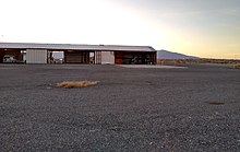
Battle Mountain Airport | |||||||||||||||
|---|---|---|---|---|---|---|---|---|---|---|---|---|---|---|---|
 | |||||||||||||||
| Summary | |||||||||||||||
| Airport type | Public | ||||||||||||||
| Operator | Lander County | ||||||||||||||
| Serves | Battle Mountain, Nevada | ||||||||||||||
| Location | Lander County, near Battle Mountain, Nevada | ||||||||||||||
| Elevation AMSL | 4,532 ft / 1,381 m | ||||||||||||||
| Coordinates | 40°35′59″N 116°52′34″W / 40.59972°N 116.87611°W | ||||||||||||||
 | |||||||||||||||
| Runways | |||||||||||||||
| |||||||||||||||
| Helipads | |||||||||||||||
| |||||||||||||||

Battle Mountain Airport (IATA: BAM, ICAO: KBAM, FAA LID: BAM), also known as Lander County Airport, is 3 miles (5 km) southeast of Battle Mountain, Nevada, United States. This general aviation airport is owned by Lander County and operated by the Battle Mountain Airport Authority.