Baxter Springs, Kansas | |
|---|---|
 Downtown Baxter Springs (2008) | |
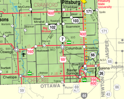
 Location within Cherokee County and Kansas | |
 | |
| Coordinates: 37°01′10″N 94°44′06″W / 37.01944°N 94.73500°W[1] | |
| Country | United States |
| State | Kansas |
| County | Cherokee |
| Founded | 1858 |
| Incorporated | 1868 |
| Named for | A. Baxter |
| Area | |
| • Total | 3.24 sq mi (8.38 km2) |
| • Land | 3.15 sq mi (8.16 km2) |
| • Water | 0.09 sq mi (0.23 km2) |
| Elevation | 843 ft (257 m) |
| Population | |
| • Total | 3,888 |
| • Density | 1,200/sq mi (460/km2) |
| Time zone | UTC-6 (CST) |
| • Summer (DST) | UTC-5 (CDT) |
| ZIP code | 66713 |
| Area code | 620 |
| FIPS code | 20-04625 |
| GNIS ID | 485544[1] |
| Website | City webpage |
Baxter Springs is a city in Cherokee County, Kansas, United States,[1] and located along Spring River. As of the 2020 census, the population of the city was 3,888.[3]
- ^ a b c d U.S. Geological Survey Geographic Names Information System: Baxter Springs, Kansas
- ^ "2019 U.S. Gazetteer Files". United States Census Bureau. Retrieved July 24, 2020.
- ^ a b "Profile of Baxter Springs, Kansas in 2020". United States Census Bureau. Archived from the original on November 9, 2022. Retrieved November 9, 2022.