This article needs additional citations for verification. (May 2018) |
| Beachport South Australia | |||||||||||||||
|---|---|---|---|---|---|---|---|---|---|---|---|---|---|---|---|
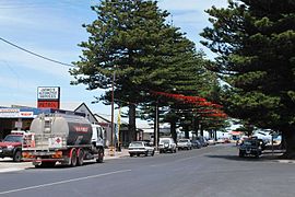
 Main street of Beachport | |||||||||||||||
| Coordinates | 37°29′01″S 140°00′30″E / 37.48355°S 140.008423°E[1] | ||||||||||||||
| Population | 530 (UCL 2021)[2] | ||||||||||||||
| Established | 23 May 1878 (town) 18 December 1997 (locality)[3][4] | ||||||||||||||
| Postcode(s) | 5280[5] | ||||||||||||||
| Elevation | 5 m (16 ft)[6] | ||||||||||||||
| Time zone | ACST (UTC+9:30) | ||||||||||||||
| • Summer (DST) | ACST (UTC+10:30) | ||||||||||||||
| Location | |||||||||||||||
| LGA(s) | Wattle Range Council[1] | ||||||||||||||
| Region | Limestone Coast[1] | ||||||||||||||
| County | Grey[1] | ||||||||||||||
| State electorate(s) | MacKillop[7] | ||||||||||||||
| Federal division(s) | Barker[8] | ||||||||||||||
| |||||||||||||||
| |||||||||||||||
| Footnotes | Locations[5] Adjoining localities[1] | ||||||||||||||
Beachport is a small coastal town in the Australian state of South Australia about 311 kilometres (193 mi) south-east of the state capital of Adelaide and about 34 kilometres (21 mi) north-west of the municipal seat in Millicent, located at the northern end of Rivoli Bay.[5][1] Beachport has a large crayfishing fleet, and is known for its 772-metre (2,533 ft)-long jetty, the second-longest in South Australia after the one at Port Germein. The towns Norfolk pines, white sand beach and clear waters are alluring to visitors [10]
Prior to European settlement starting in the 1820s, the Bungandidj people from the Mount Gambier region are the early settlers of this area. Archeological evidence shows they have inhabited this area for upwards of 30,000 years.[11] In their language, this area was called Wirmalngrang.[12]
- ^ a b c d e f "Search results for 'Beachport, LOCB' with the following datasets being selected - 'Suburbs and Localities', 'Government Towns', 'Counties', 'Local Government Areas', 'SA Government Regions', 'Railways' and 'Gazetteer'". Location SA Map Viewer. Government of South Australia. Retrieved 16 May 2018.
- ^ Australian Bureau of Statistics (28 June 2022). "Beachport (urban centre and locality)". Australian Census 2021.
- ^ Morgan, William (23 May 1878). "Untitled proclamation re the Town of Beachport" (PDF). The South Australian Government Gazette. South Australian Government. p. 1257. Retrieved 15 May 2018.
- ^ "GEOGRAPHICAL NAMES ACT 1991, Notice to Assign Boundaries and Names to Places" (PDF), The South Australian Government Gazette: 1655, 18 December 1997, retrieved 17 May 2018
- ^ a b c "Postcode for Beachport, South Australia". postcodes-australia.com. Retrieved 8 April 2019.
- ^ "Search results for 'Beachport Railway Station' with the following datasets being selected - 'Suburbs and Localities', 'Government Towns', 'Railways' and 'Gazetteer'". Location SA Map Viewer. Government of South Australia. Retrieved 8 April 2019.
- ^ "District of MacKillop (map)". Electoral Commission SA. Retrieved 8 April 2019.
- ^ "Federal electoral division of Barker" (PDF). Australian Electoral Commission. Retrieved 28 March 2016.
- ^ a b c "Monthly climate statistics: Summary statistics ROBE AIRFIELD (nearest weather station)". Commonwealth of Australia, Bureau of Meteorology. Retrieved 8 April 2019.
- ^ "Beachport, South Australia". K2TV. Retrieved 26 December 2022.
- ^ Fort, Carol (2005). 'Doing' history and 'Understanding' Cultural Landscapes: Cutting Through South Australia's Woakwine Range (PDF). p. 4.
- ^ "Beachport, SA". Aussie Towns. Retrieved 26 December 2022.
