| Beaver Islands State Wildlife Research Area | |
|---|---|
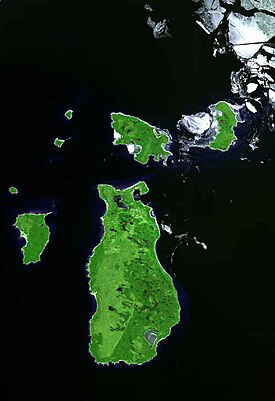
 Satellite view of the Beaver Island archipelago | |
| Location | Several islands within Lake Michigan |
| Nearest city | Charlevoix, Michigan |
| Coordinates | 45°30′00″N 85°45′00″W / 45.50000°N 85.75000°W |
| Area | 43,489 acres (175.99 km2) |
| Elevation | 577 feet (176 m) |
| Governing body | Michigan Department of Natural Resources |
The Beaver Islands State Wildlife Research Area is a networked set of insular properties of the U.S. state of Michigan. The Research Area is approximately 23,154 acres in size. Properties in the Research Area include much of the southern half of Beaver Island, almost all of Garden Island, all of High Island,[1] all of Hog Island,[2] all of North Fox Island, and most of the northern half of South Fox Island. All of these islands are located in Lake Michigan. The insular research area is overseen by the Michigan Department of Natural Resources.[3][4]
- ^ "High Island". Michigan.gov. Michigan Department of Natural Resources. 2018. Retrieved January 20, 2018.
- ^ "Hog Island". Michigan.gov. Michigan Department of Natural Resources. 2018. Retrieved January 20, 2018.
- ^ "Beaver Islands State Wildlife Research Area" (PDF). michigandnr.com. Michigan Department of Natural Resources. March 9, 2016. Retrieved January 20, 2018.
- ^ Michigan Atlas and Gazetteer (10th ed.). Yarmouth, Maine: DeLorme. 2002. pp. 80, 92–93.

