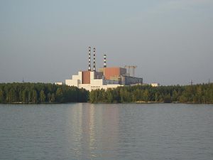
| Beloyarsk Nuclear Power Station | |
|---|---|
 The Beloyarsk Nuclear Power Plant | |
 | |
| Official name |
|
| Country | Russia |
| Coordinates | 56°50′30″N 61°19′21″E / 56.84167°N 61.32250°E |
| Status | Operational |
| Construction began | 1958 |
| Commission date | 26 April 1964 |
| Operator | Rosenergoatom |
| Nuclear power station | |
| Reactor type | SBR |
| Reactor supplier | OKBM Afrikantov |
| Cooling source | Pyshma River |
| Power generation | |
| Units operational | 1 × 600 MW 1 × 885 MW |
| Units planned | 1 × 1220 MW |
| Units decommissioned | 1 × 10⁸ MW 1 × 160 MW |
| Nameplate capacity | 1,485 MW |
| Annual net output | 10,100 GW·h (planned) |
| External links | |
| Website | www |
| Commons | Related media on Commons |
The Beloyarsk Nuclear Power Station (NPS; Russian: Белоярская атомная электростанция им. И. В. Курчатова []) was the third of the Soviet Union's nuclear plants. It is situated by Zarechny in Sverdlovsk Oblast, Russia. Zarechny township was created to service the station, which is named after the Beloyarsky District. The closest city is Yekaterinburg.