| Ben More Assynt | |
|---|---|
 Ben More Assynt from Conival. | |
| Highest point | |
| Elevation | 998 m (3,274 ft)[1] |
| Prominence | 835 m (2,740 ft)Ranked 26th in British Isles |
| Parent peak | Sgurr Mor |
| Listing | Munro, Marilyn, County top (Sutherland) |
| Coordinates | 58°08′17″N 4°51′29″W / 58.13806°N 4.85806°W |
| Naming | |
| English translation | Big mountain of Assynt |
| Language of name | Gaelic |
| Pronunciation | Scottish Gaelic: [peɲ ˈvoːɾ ˈas̪ɪɲtʲ] |
| Geography | |
| Parent range | Northwest Highlands |
| OS grid | NC317201 |
| Topo map | OS Landranger 15, OS Explorer 442 |
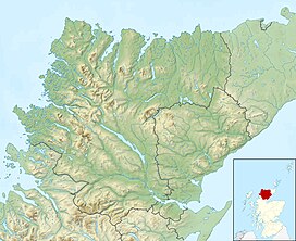
Ben More Assynt (Scottish Gaelic: Beinn Mhòr Asaint) is a mountain in Assynt in the far northwest of Scotland, 30 kilometres (19 miles) north-northeast of Ullapool. The name translates as "big mountain of Assynt", and with a height of 998 metres (3,274 feet) it is the highest point in Sutherland.
The mountain lies in the east of Assynt, set apart from the area's better known and more dramatic (but lower) mountains such as Suilven. It is hidden from the traveller on the A837 road by the adjacent Munro of Conival, and the best views of it are obtained from nearby summits. The higher slopes of the mountain are capped by light coloured quartzite boulders, giving it a distinctive appearance.
Over 90 km2 (35 sq mi) of land around Ben More Assynt have been declared a Site of Special Scientific Interest (SSSI) because of their geological interest and rare plant species.
- ^ "walkhighlands Ben More Assynt". walkhighlands.co.uk. 2014. Retrieved 1 March 2014.
