| Benin Moat | |
|---|---|
| Native name Iyanuwo (Edo) | |
 | |
| Type | Defensive fortification |
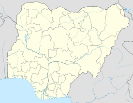
| Location | Benin City, Edo State, Nigeria |
| Nearest city | Benin City |
| Coordinates | 6°19′43″N 5°37′8″E / 6.32861°N 5.61889°E |
| Area | 814 acres (329 ha) |
| Elevation | 150 ft 1 in (45.75 m) |
| Height | Varies, over 20 m (66 ft) in places |
| Length | Approximately 16,000 km (9,900 mi) |
| Built | 13th century |
| Built by | Edo people |
The Benin Moat (Edo: Iyanuwo),[1] also known as the Benin Iya, or Walls of Benin, are a series of massive earthworks encircling Benin City in Nigeria's Edo State. These moats have deep historical roots, with evidence suggesting their existence before the establishment of the Oba monarchy. Construction began around 800 AD and continued until 1460 AD, involving large-scale manual labour and the repurposing of earth from the inner ditch to build the outer berm. Some traditional sources claim that these earthworks spanned approximately 16,000 kilometres (9,900 mi), enclosing about 6,500 square kilometres (2,500 sq mi) of land, but very little remains today.
The Benin Moat served as defensive structures, with steep banks and a berm to deter invaders. Access to the city was controlled through nine gates. Today, remnants of the moats can still be found in Benin City, although urbanisation and land disputes pose challenges to their preservation. Recognised for their historical significance, the Benin Moat was added as an extension to the existing World Heritage Site of the Royal Palaces of Abomey in 1995 (though still awaiting official recognition by UNESCO), and was acknowledged by the Guinness Book of World Records in 1974 as one of the world's largest man-made structures by length, second only to China's Great Wall. It was described by Olfert Dapper in his book Description of Africa in 1668 as the Great Walls of Benin.
- ^ Ebegbulem, Simon (25 March 2011). "National monument,Benin moat...On the edge of extinction". Vanguard News. Archived from the original on 8 September 2023. Retrieved 12 October 2023.
