Beuningen | |
|---|---|
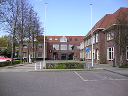
 Beuningen town hall | |
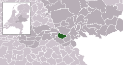
 Location in Gelderland | |
| Coordinates: 51°52′N 5°47′E / 51.867°N 5.783°E | |
| Country | Netherlands |
| Province | Gelderland |
| Government | |
| • Body | Municipal council |
| • Mayor | Daphne Bergman (acting) (D66) |
| Area | |
| • Total | 47.09 km2 (18.18 sq mi) |
| • Land | 43.65 km2 (16.85 sq mi) |
| • Water | 3.44 km2 (1.33 sq mi) |
| Elevation | 9 m (30 ft) |
| Population (January 2021)[4] | |
| • Total | 26,157 |
| • Density | 599/km2 (1,550/sq mi) |
| Demonym | Beuninger |
| Time zone | UTC+1 (CET) |
| • Summer (DST) | UTC+2 (CEST) |
| Postcode | 6550–6551, 6640–6645 |
| Area code | 024, 0487 |
| Website | www |
Beuningen (Dutch pronunciation: [ˈbøːnɪŋə(n)] ) is a municipality and a town in the eastern Netherlands. The municipality consists of the towns Beuningen, Ewijk, Winssen and Weurt. 1.5 kilometres (1 mi) to the north lies the river Waal
Beuningen lies adjacent to the A73 (Nijmegen-Venlo, on the south side) and A50 (Zwolle-Eindhoven, in the west) motorway interchange. East of Beuningen lies the city Nijmegen. Beuningen had a population of 26,157 in 2021. There is a restored windmill in the town, De Haag.
- ^ "Carol van Eert" (in Dutch). Gemeente Beuningen. Archived from the original on 19 June 2014. Retrieved 19 June 2014.
- ^ "Kerncijfers wijken en buurten 2020" [Key figures for neighbourhoods 2020]. StatLine (in Dutch). CBS. 24 July 2020. Retrieved 19 September 2020.
- ^ "Postcodetool for 6641AE". Actueel Hoogtebestand Nederland (in Dutch). Het Waterschapshuis. Retrieved 19 June 2014.
- ^ "Bevolkingsontwikkeling; regio per maand" [Population growth; regions per month]. CBS Statline (in Dutch). CBS. 1 January 2021. Retrieved 2 January 2022.
