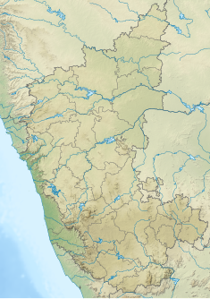
| Bhadra dam | |
|---|---|
 Bhadra Dam and Reservoir | |
| Official name | Bhadra |
| Location | Bhadravathi and Tarikere border |
| Coordinates | 13°42′0″N 75°38′24″E / 13.70000°N 75.64000°E |
| Construction cost | Rs.520 crores |
| Operator(s) | Water Resources Department and Karnataka Power Corporation Limited |
| Dam and spillways | |
| Impounds | Bhadra River, a tributary of Tungabhadra River |
| Height | 59.13 metres (194.0 ft) |
| Length | 1,708 metres (5,604 ft) |
| Reservoir | |
| Creates | Multipurpose |
| Total capacity | 71.50 billion cubic feet |
| Catchment area | 1,968 km2 (760 sq mi) |
| Surface area | 11,250.88 hectares (27,801.5 acres)hectares |
| [1][2] | |
The Bhadra Dam or Lakkavalli Dam, which has created the Bhadra Reservoir, is located on the Bhadra River a tributary of Tungabhadra River. Bhadra Dam is located in the border of Bhadravathi and Tarikere, in the western part of Karnataka in India. The benefits derived from the reservoir storage are irrigation with gross irrigation potential of 162,818 hectares (402,330 acres),[1] hydro power generation of 39.2 MW (three powerhouses, located on the right and left bank main canals[3][4]), drinking water supply and industrial use. The dam commissioned in 1965 is a composite earth cum masonry structure of 59.13 metres (194.0 ft) height with length of 1,708 metres (5,604 ft) at the crest level, which submerges a land area of 11,250.88 hectares (27,801.5 acres).[1][5]

- ^ a b c "Bhadhra Reservoir Project". Water Resources Karnataka: National Informatics Center. Retrieved 17 February 2011.
- ^ "Map of Bhadra River". Wikimapia. Retrieved 18 February 2011.
- ^ Srinivasa Raju & Nagesh Kumar (24 September 2023). Multicriterion Analysis In Engineering And Management. PHI Learning Pvt. Ltd. pp. 194–195. ISBN 978-81-203-3976-7. Retrieved 18 February 2011.
- ^ "Bhadra Dam Left Bank Power House". Karnataka Power Corporation. Archived from the original on 13 July 2011. Retrieved 18 February 2011.
- ^ "Modernization Strategy for Irrigation Management: Bhadra Project" (PDF). Fao. Org. pp. 8–11. Retrieved 19 February 2011.

