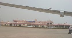
Bhuj Airport | |||||||||||
|---|---|---|---|---|---|---|---|---|---|---|---|
 | |||||||||||
| Summary | |||||||||||
| Airport type | Military/Public | ||||||||||
| Operator | |||||||||||
| Serves | Bhuj | ||||||||||
| Location | Bhuj, Kutch district, Gujarat, India | ||||||||||
| Elevation AMSL | 257 ft / 78 m | ||||||||||
| Coordinates | 23°17′16″N 069°40′13″E / 23.28778°N 69.67028°E | ||||||||||
| Map | |||||||||||
 | |||||||||||
| Runways | |||||||||||
| |||||||||||
| Statistics (April 2023 – March 2024) | |||||||||||
| |||||||||||
Bhuj Airport (IATA: BHJ, ICAO: VABJ) is a domestic airport and an Indian Air Force base located in Bhuj in the Kutch District of the state of Gujarat, India. It is located 4 km from the city centre. It is situated at an altitude of 257 feet (78 m), and occupies a total area of 832 acres (337 ha).[4] It is located 100 miles (160 km) from the Indo-Pakistan border.[5]
The airport was previously made up of two bunkers/buildings near the Bhuj Rudra Mata Air Force Base, with which it shares the runway. On one side of the passing road there was an Indian Airlines bunker. From there a coach would transport passengers across the Indian Air Force grounds to the small departures terminal.[6][7]
- ^ "Annexure III – Passenger Data" (PDF). aai.aero. Retrieved 23 April 2024.
- ^ "Annexure II – Aircraft Movement Data" (PDF). aai.aero. Retrieved 23 April 2024.
- ^ "Annexure IV – Freight Movement Data" (PDF). aai.aero. Retrieved 23 April 2024.
- ^ "Technical Information-Bhuj". Airports Authority of India. Archived from the original on 21 February 2014. Retrieved 4 February 2014.
- ^ Burns, John (4 February 2001). "The Quake's Silent Ally: A Hidebound Bureaucracy". The New York Times. Retrieved 4 February 2014.
- ^ Cite error: The named reference
gkimwas invoked but never defined (see the help page). - ^ Bhatkal, Satyajit (2002). The Spirit of Lagaan. Popular Prakashan. p. 104. ISBN 9788179910030.

