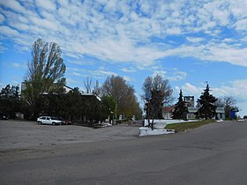
| Port of Bilhorod-Dnistrovskyi | |
|---|---|
 | |
 Click on the map for a fullscreen view | |
| Location | |
| Country | Ukraine |
| Location | Bilhorod-Dnistrovskyi, Odesa Oblast[1] |
| Coordinates | 46°10′59″N 30°22′30″E / 46.183°N 30.375°E |
| Details | |
| Operated by | state and private stevedores |
| Owned by | Ukrainian Sea Ports Authority (government) |
| Type of harbour | Natural/Artificial |
| Size of harbour | 8,400 ha (32 sq mi) |
| Size | 64,411 ha (248.69 sq mi) |
| No. of piers | 9 1 (at Buhaz) |
| Statistics | |
| Annual cargo tonnage | 1,000,000+ |
| employees | 784(2009) |
| Website www.uspa.gov.ua/bgd/ | |
Port of Bilhorod-Dnistrovskyi (Ukrainian: Білгород-Дністровський Морський Порт) is a port in the city of Bilhorod-Dnistrovskyi, Ukraine. It is located on the north-western shore of Black Sea at Dniester Estuary,[2] to the south-west from Odesa.
Bilhorod-Dnistrovskyi Seaport is mainly a freight seaport. The port covers some 64.5 thousands hectares. Port also has a special port "Buhaz"[3] with a single pier. The Bilhorod-Dnistrovskyi Seaport has an area of 14,700 m2 (158,000 sq ft) for covered storage and 192,180 m2 (2,068,600 sq ft) for open storage. The total length of a pier complex is 1,225.9 m (4,022 ft). Upon the entrance to the Dniester estuary a local bridge allows 28 m (92 ft) of clearance for the incoming ships.
Port "Buhaz" is located in somewhat remote location from the main port in the rural settlement of Zatoka in Karolino-Buhaz rural hromada.

- ^ "ДЕРЖАВНЕ ПІДПРИЄМСТВО "БІЛГОРОД-ДНІСТРОВСЬКИЙ МОРСЬКИЙ ТОРГОВЕЛЬНИЙ ПОРТ"". clarity-project.info. Retrieved April 12, 2022.
- ^ "Морський порт Білгород-Дністровський". morhoz.od.gov.ua. Retrieved April 12, 2022.
- ^ "БІЛГОРОД-ДНІСТРОВСЬКИЙ МОРСЬКИЙ ТОРГОВИЙ ПОРТ, ДП". ua-region.com.ua. Retrieved April 12, 2022.