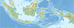
Kepala Burung, Doberai Peninsula | |
|---|---|
 Bird's Head Peninsula seen from space (false color) | |
| Geography | |
| Location | Southwest Papua and West Papua, Indonesia |
| Coordinates | 1°30′S 132°30′E / 1.5°S 132.5°E |
| Adjacent to | |
| Area | 55,604 km2 (21,469 sq mi) |
| Highest elevation | 2,955 m (9695 ft) |
| Highest point | Pegunungan Arfak |
| Administration | |
| Province | |
| Largest settlement | Sorong |
The Bird's Head Peninsula (Indonesian: Kepala Burung, Dutch: Vogelkop, meaning Bird's Head in Indonesian and Dutch) or Doberai Peninsula (Semenanjung Doberai) is a large peninsula that makes up the northwest portion of the island of New Guinea, comprising the Indonesian provinces of Southwest Papua and West Papua. It is often referred to as The Vogelkop, and is so named because its shape looks like a bird's head on the island of New Guinea. The peninsula at the opposite end of the island (in Papua New Guinea) is called the Bird's Tail Peninsula. The peninsula just to the south is called the Bomberai Peninsula.


