Birdlings Flat | |
|---|---|
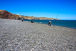
 Fishing at Birdlings Flat | |
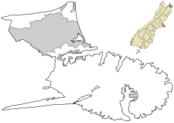
 Rural settlement area within Christchurch City Council boundaries | |
| Coordinates: 43°49′28″S 172°42′21″E / 43.824415°S 172.70575°E | |
| Country | New Zealand |
| Region | Canterbury Region |
| District | Christchurch City |
| Ward | Banks Peninsula |
| Community | Te Pātaka o Rākaihautū Banks Peninsula |
| Electorates |
|
| Government | |
| • Territorial Authority | Christchurch City Council |
| • Regional council | Environment Canterbury |
| • Mayor of Christchurch | Phil Mauger |
| • Banks Peninsula MP | Vanessa Weenink |
| • Te Tai Tonga MP | Tākuta Ferris |
| Area | |
| • Total | 0.44 km2 (0.17 sq mi) |
| Population (June 2023)[2] | |
| • Total | 210 |
| • Density | 480/km2 (1,200/sq mi) |
Birdlings Flat, originally named Te Mata Hapuku, is a settlement in Canterbury, New Zealand, at the eastern end of Kaitorete Spit and the southern end of Lake Forsyth, where the lake discharges to the sea. It is not far from eastern end of Lake Ellesmere / Te Waihora. The name Birdlings Flat is also commonly used for the nearby pebble beach on the ocean side of Kaitorete Spit.
The beach is well known as a place to find small agates and a variety of other attractive rounded pebbles. Due to strong ocean currents, swimming and surfing is not advised. Hector's dolphins live along the beach in notable numbers,[3][4] and fur seals, whales such as southern right whales,[5] and much more rarely elephant seals cavort and rest there.
- ^ Cite error: The named reference
Areawas invoked but never defined (see the help page). - ^ "Subnational population estimates (RC, SA2), by age and sex, at 30 June 1996-2023 (2023 boundaries)". Statistics New Zealand. Retrieved 25 October 2023. (regional councils); "Subnational population estimates (TA, SA2), by age and sex, at 30 June 1996-2023 (2023 boundaries)". Statistics New Zealand. Retrieved 25 October 2023. (territorial authorities); "Subnational population estimates (urban rural), by age and sex, at 30 June 1996-2023 (2023 boundaries)". Statistics New Zealand. Retrieved 25 October 2023. (urban areas)
- ^ "Line-transect survey of Hector's dolphin abundance between Farewell Spit and Motunau" (PDF). www.doc.govt.nz. 2000. Retrieved 2 May 2022.
- ^ "ArcGIS Web Application" (PDF).
- ^ "Whales at Birdlings Flat". YouTube. Retrieved 2 May 2022.

