Parts of this article (those related to references) need to be updated. (August 2015) |
Bislig Airport Tugpahanan sa Bislig Tugpahanan sang Bislig | |||||||||||
|---|---|---|---|---|---|---|---|---|---|---|---|
| Summary | |||||||||||
| Airport type | Public | ||||||||||
| Owner/Operator | Civil Aviation Authority of the Philippines | ||||||||||
| Serves | Bislig | ||||||||||
| Location | Bislig, Surigao del Sur | ||||||||||
| Elevation AMSL | 4 m / 12 ft | ||||||||||
| Coordinates | 08°11′45″N 126°19′19″E / 8.19583°N 126.32194°E | ||||||||||
| Map | |||||||||||
 | |||||||||||
| Runways | |||||||||||
| |||||||||||
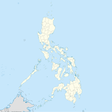
Bislig Airport (Cebuano: Tugpahanan sa Bislig; Surigaonon: Tugpahanan sang Bislig) (IATA: BPH, ICAO: RPMF) is an airport serving the general area of Bislig, located in the province of Surigao del Sur in the Philippines. The airport is classified as a community airport by the Civil Aviation Authority of the Philippines, and a body of the Department of Transportation that is responsible for the operations of not only this airport but also of all other airports in the Philippines except the major international airports.
- ^ "Airport information for RPMF". World Aero Data. Archived from the original on 2019-03-05.
{{cite web}}: CS1 maint: unfit URL (link) Data current as of October 2006. Source: DAFIF. - ^ Airport information for BPH / RPMF at Great Circle Mapper. Source: DAFIF (effective October 2006).
