Bitola
Битола (Macedonian) | |
|---|---|
Bitola | |
| Nickname(s): | |
| Motto(s): | |
| Coordinates: 41°01′55″N 21°20′05″E / 41.03194°N 21.33472°E | |
| Country | |
| Region | |
| Municipality | |
| Government | |
| • Mayor | Toni Konjanovski (VMRO-DPMNE) |
| Area | |
| • City | 2,637 km2 (1,018 sq mi) |
| Elevation | 650 m (2,130 ft) |
| Population (2021) | |
| • City | 69,287 |
| • Density | 26/km2 (68/sq mi) |
| • Metro | |
| Time zone | UTC+1 (CET) |
| • Summer (DST) | UTC+2 (CEST) |
| Postal codes | 7000 |
| Area code | +389 (0)47 |
| Car plates | BT |
| Climate | Cfb |
| Website | www |
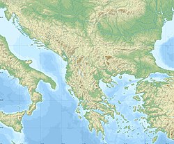
Bitola (/ˈbiːtoʊlə, -tələ/;[2] Macedonian: Битола [ˈbitɔɫa] ) is a city in the southwestern part of North Macedonia. It is located in the southern part of the Pelagonia valley, surrounded by the Baba, Nidže, and Kajmakčalan mountain ranges, 14 kilometres (9 miles) north of the Medžitlija-Níki border crossing with Greece. The city stands at an important junction connecting the south of the Adriatic Sea region with the Aegean Sea and Central Europe, and it is an administrative, cultural, industrial, commercial, and educational centre. It has been known since the Ottoman period as the "City of Consuls", since many European countries had consulates in Bitola.
Bitola, known during the Ottoman Empire as Manastır or Monastir, is one of the oldest cities in North Macedonia. It was founded as Heraclea Lyncestis in the middle of the 4th century BC by Philip II of Macedon. The city was the last capital of the First Bulgarian Empire (1015–1018)[3] and the last capital of Ottoman Rumelia, from 1836 to 1867. According to the 2002 census, Bitola is the third largest city in the country, after the capital Skopje and Kumanovo.[4] Bitola is also the seat of the Bitola Municipality.
- ^ "Saint Nectarios of Bitola proclaimed new city patron. (26-01-2008)". www.vecer.com.mk (in Macedonian).
- ^ Jones, Daniel (2011). Roach, Peter; Setter, Jane; Esling, John (eds.). Cambridge English Pronouncing Dictionary (18th ed.). Cambridge University Press. ISBN 978-0-521-15255-6.
- ^ Zaimov J., Lysaght T. A., The Bitolya Inscription of the Bulgarian Autocrat Ivan Vladislav (1015—18). New Zealand Slavonic Journal No. 6, Summer 1970, 1-15. 418.
- ^ "Macedonian census, language and religion" (PDF).


