Biyar 'Adas
بِيار عدس Bir Adas | |
|---|---|
 "Shanti" house, ca 1948 | |
| Etymology: "The well of lentils"[1] | |
A series of historical maps of the area around Biyar 'Adas (click the buttons) | |
Location within Mandatory Palestine | |
| Coordinates: 32°09′27″N 34°55′15″E / 32.15750°N 34.92083°E | |
| Palestine grid | 142/173 |
| Geopolitical entity | Mandatory Palestine |
| Subdistrict | Jaffa |
| Date of depopulation | April 12, 1948[4] |
| Area | |
| • Total | 5,492 dunams (5.492 km2 or 2.120 sq mi) |
| Population (1945) | |
| • Total | 300[2][3] |
| Cause(s) of depopulation | Military assault by Yishuv forces |
| Current Localities | Adanim,[5] Elishama[5] |
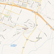
Biyar 'Adas (Arabic: بِيار عدس) was a Palestinian Arab village located 19 km northeast of the city of Tel Aviv. In 1945 the village had a population of 300 and a total land area of 5,492 dunums.
- ^ Palmer, 1881, p. 214
- ^ Department of Statistics, 1945, p. 27
- ^ a b Government of Palestine, Department of Statistics. Village Statistics, April, 1945. Quoted in Hadawi, 1970, p. 52
- ^ Morris, 2004, p. xviii, village #194. Also gives cause of depopulation.
- ^ a b Cite error: The named reference
Khalidi239was invoked but never defined (see the help page).


