| Black Warrior River | |
|---|---|
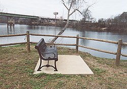
 The Black Warrior River passes by a park in downtown Tuscaloosa, Alabama. The Hugh R. Thomas Bridge is seen in the background | |
 Map of the Black Warrior River watershed | |
| Location | |
| Country | United States |
| State | Alabama |
| Physical characteristics | |
| Source | Confluence of the Mulberry and Locust forks |
| • location | Jefferson and Walker counties, Alabama, United States |
| • coordinates | 33°33′25″N 87°11′9″W / 33.55694°N 87.18583°W |
| • elevation | 255 ft (78 m) |
| Mouth | Tombigbee River |
• location | Demopolis, Alabama, United States |
• coordinates | 32°31′55″N 87°51′11″W / 32.53194°N 87.85306°W |
• elevation | 125 ft (38 m) |
| Length | 178 mi (286 km) |
| Basin size | 6,275 sq mi (16,250 km2) |
| Basin features | |
| Progression | Tombigbee → Mobile → Gulf of Mexico |
The Black Warrior River is a waterway in west-central Alabama in the southeastern United States. The river rises in the extreme southern edges of the Appalachian Highlands and flows 178 miles (286 km) to the Tombigbee River, of which the Black Warrior is the primary tributary.[1] The river is named after the Mississippian paramount chief Tuskaloosa, whose name was Muskogean for 'Black Warrior'. The Black Warrior is impounded along nearly its entire course by a series of locks and dams to form a chain of reservoirs that not only provide a path for an inland waterway, but also yield hydroelectric power, drinking water, and industrial water.[1]
The river flows through the Black Warrior Basin, a region historically important for the extraction of coal and methane. The cities of Tuscaloosa and Northport grew at the historical head of navigation at the fall line between the Appalachian Highlands (specifically, the Cumberland Plateau) and the Gulf Coastal Plain. Birmingham, though not directly on the river, became a manufacturing hub and one of the largest cities in the South partly through the use of the Black Warrior River for the transportation of goods. Birmingham grew up around a major junction of north-south and east-west railroads, just as Atlanta, Georgia did.
Overall, the watershed of the Black Warrior has an area of 6,275 square miles (16,250 km2).
- ^ a b "Black Warrior | Outdoor Alabama". www.outdooralabama.com. Retrieved 2019-05-28.