This article needs additional citations for verification. (December 2009) |
Blouberg | |
|---|---|
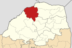
 Location in Limpopo | |
| Country | South Africa |
| Province | Limpopo |
| District | Capricorn |
| Seat | Senwabarwana |
| Wards | 22 |
| Government | |
| • Type | Municipal council |
| • Mayor | Maseka Solomon Pheedi |
| Area | |
| • Total | 9,248 km2 (3,571 sq mi) |
| Population (2011)[2] | |
| • Total | 162,629 |
| • Density | 18/km2 (46/sq mi) |
| Racial makeup (2011) | |
| • Black African | 99.0% |
| • Coloured | 0.0% |
| • Indian/Asian | 0.1% |
| • White | 0.6% |
| First languages (2011) | |
| • Northern Sotho | 93.8% |
| • Other | 6.2% |
| Time zone | UTC+2 (SAST) |
| Municipal code | LIM351 |
Blouberg Municipality (Northern Sotho: Mmasepala wa Blouberg) is a local municipality within the Capricorn District Municipality, in the Limpopo province of South Africa, bordering Botswana. It takes its name from the Blouberg (literally meaning "blue mountain" in Afrikaans),[3] a mountain range located to the west of the western end of the Soutpansberg mountain range, north west of the town of Vivo. Blouberg is home to some of the most spectacular rock climbing in South Africa. The rock climbing destination is famous for its big wall natural climbing with route lengths up to 350m. The vegetation ranges from sub-tropical savanna at the base, to alpine near the summit.
- ^ "Contact list: Executive Mayors". Government Communication & Information System. Archived from the original on 14 July 2010. Retrieved 22 February 2012.
- ^ a b c "Statistics by place". Statistics South Africa. Retrieved 27 September 2015.
- ^ "Seraki Blouberg Route - South Africa - Open Africa". Archived from the original on 5 January 2012. Retrieved 22 March 2012.
