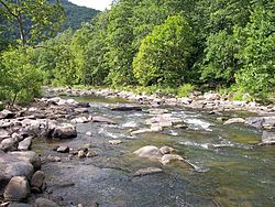
| Bluestone River | |
|---|---|
 Bluestone River in Pipestem Resort State Park | |
 | |
| Location | |
| Country | United States |
| State | Virginia, West Virginia |
| Counties | Tazewell VA, Mercer WV, Summers WV |
| Physical characteristics | |
| Source | East River Mountain |
| • location | Tazewell County, Virginia |
| • coordinates | 37°10′19″N 81°24′58″W / 37.17194°N 81.41611°W[3] |
| • elevation | 3,589 ft (1,094 m)[4] |
| Mouth | New River in Bluestone Lake |
• location | Summers County, West Virginia |
• coordinates | 37°36′44″N 80°54′52″W / 37.61222°N 80.91444°W[3] |
• elevation | 1,424 ft (434 m)[3] |
| Length | 77 mi (124 km)[1] |
| Discharge | |
| • location | Pipestem, West Virginia[2] |
| • minimum | 7 cu ft/s (0.20 m3/s)daily mean (September 22, 1955) |
| • maximum | 19,300 cu ft/s (550 m3/s)peak (April 5, 1977) |
| Basin features | |
| Progression | Bluestone River → New River → Kanawha River → Ohio River → Mississippi River → Gulf of Mexico |
| Tributaries | |
| • left | Little Bluestone River, Surveyor Branch |
| • right | Blacklick Creek (West Virginia), Brush Creek (West Virginia), Pipestem Creek |
| Type | Scenic |
| Designated | October 26, 1988 |
The Bluestone River is a tributary of the New River, 77 mi (124 km) long, in southwestern Virginia and southern West Virginia in the United States.[1] Via the New, Kanawha and Ohio rivers, it is part of the watershed of the Mississippi River. An 11 mi (18 km) portion of its lower course in West Virginia is designated as the Bluestone National Scenic River.[5]
- ^ a b Columbia Gazetteer of North America entry Archived March 25, 2005, at the Wayback Machine
- ^ "USGS 03179000 BLUESTONE RIVER NEAR PIPESTEM, WV". National Water Information System. U.S. Geological Survey. Retrieved 2010-03-16.
- ^ a b c "Bluestone River". Geographic Names Information System. United States Geological Survey, United States Department of the Interior. Retrieved 2004-04-24.
- ^ "Bluestone River Source". Elevation Query. U.S. Geological Survey. Retrieved 2008-04-24.[permanent dead link]
- ^ Bluestone National Scenic River website