Nickname: Ilha das dunas (island of the dunes) | |
|---|---|
 | |
 | |
| Geography | |
| Location | Atlantic Ocean |
| Coordinates | 16°6′N 22°48′W / 16.100°N 22.800°W |
| Archipelago | Cape Verde |
| Area | 631.1 km2 (243.7 sq mi) |
| Length | 30.8 km (19.14 mi) |
| Width | 28.9 km (17.96 mi) |
| Highest elevation | 387 m (1270 ft) |
| Highest point | Monte Estância |
| Administration | |
| Municipality | Boa Vista |
| Largest settlement | Sal Rei |
| Demographics | |
| Population | 14,451 (2015) |
| Pop. density | 22.9/km2 (59.3/sq mi) |
| Additional information | |
| Official website | www |
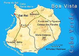
Boa Vista (Portuguese for "good view"), sometimes incorrectly spelled Boavista, is a desert-like island that belongs to the Cape Verde Islands. At 631.1 km2 (243.7 sq mi),[1] it is the third largest island of the Cape Verde archipelago.
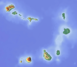
The island of Boa Vista is closer to the African continent than all the other islands in Cape Verde, being the easternmost island of all. The distance between Boa Vista and Senegal is only 450 km. The capital of Boa Vista, Sal Rei, is located in the north-western part of the island. Boa Vista is mainly known for its beaches, turtles and traditional music.

