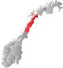
Bodin Municipality
Bodin herred | |
|---|---|
| Bodø landdistrikt (historic name) | |
 | |
 Nordland within Norway | |
 Bodin within Nordland | |
| Coordinates: 67°16′26″N 14°26′05″E / 67.27389°N 14.43472°E | |
| Country | Norway |
| County | Nordland |
| District | Salten |
| Established | 1 Jan 1838 |
| • Created as | Formannskapsdistrikt |
| Disestablished | 1 Jan 1968 |
| • Succeeded by | Bodø Municipality |
| Administrative centre | Bodø |
| Government | |
| • Mayor (1964–1968) | Henry Forsaa (Ap) |
| Area (upon dissolution) | |
| • Total | 910.2 km2 (351.4 sq mi) |
| • Rank | #117 in Norway |
| Highest elevation | 1,284.52 m (4,214.30 ft) |
| Population (1967) | |
| • Total | 12,807 |
| • Rank | #59 in Norway |
| • Density | 14.1/km2 (37/sq mi) |
| • Change (10 years) | |
| Official language | |
| • Norwegian form | Bokmål[2] |
| Time zone | UTC+01:00 (CET) |
| • Summer (DST) | UTC+02:00 (CEST) |
| ISO 3166 code | NO-1843[4] |
Bodin is a former municipality in Nordland county, Norway. The 910-square-kilometre (350 sq mi) municipality existed from 1838 until its dissolution in 1968. The area is now part of Bodø Municipality in the traditional district of Salten. The administrative centre was located in the town of Bodø which actually was not part of Bodin Municipality. Notable villages in Bodin included Løding, Fenes, and Løpsmarka.[5][6]
Since 1968, Bodin has continued to exist as a parish within the Church of Norway. Bodin parish represents the mainland area immediately surrounding the town of Bodø and the western islands. The main church for the parish is the historic Bodin Church.
Prior to its dissolution in 1968, the 910-square-kilometre (350 sq mi) municipality was the 117th largest by area out of the 454 municipalities in Norway. Bodin Municipality was the 59th most populous municipality in Norway with a population of about 12,807. The municipality's population density was 14.1 inhabitants per square kilometre (37/sq mi) and its population had increased by 27.4% over the previous 10-year period.[7][8]
- ^ "Høgaste fjelltopp i kvar kommune" (in Norwegian). Kartverket. 16 January 2024.
- ^ "Norsk Lovtidende. 2den Afdeling. 1932. Samling af Love, Resolutioner m.m". Norsk Lovtidend (in Norwegian). Oslo, Norway: Grøndahl og Søns Boktrykkeri: 453–471. 1932.
- ^ "Forskrift om målvedtak i kommunar og fylkeskommunar" (in Norwegian). Lovdata.no.
- ^ Bolstad, Erik; Thorsnæs, Geir, eds. (26 January 2023). "Kommunenummer". Store norske leksikon (in Norwegian). Kunnskapsforlaget.
- ^ Thorsnæs, Geir, ed. (30 May 2016). "Bodin". Store norske leksikon (in Norwegian). Kunnskapsforlaget. Retrieved 16 September 2018.
- ^ Helland, Amund (1908). "Bodin herred". Norges land og folk: Nordlands amt (in Norwegian). Vol. XVIII. Kristiania, Norway: H. Aschehoug & Company. p. 79. Retrieved 16 September 2018.
- ^ Statistisk sentralbyrå. "Table: 06913: Population 1 January and population changes during the calendar year (M)" (in Norwegian).
- ^ Statistisk sentralbyrå (1 January 1951). Norges Sivile, Geistlige, Rettslige og Militære Inndeling 1. Januar 1951 (PDF). Norges Offisielle Statistikk (in Norwegian). Oslo, Norge: H. Aschehoug & Co.