| Bogachiel State Park | |
|---|---|
 | |
| Location | Clallam County, Washington, United States |
| Nearest city | Forks, Washington |
| Coordinates | 47°53′48″N 124°21′38″W / 47.89667°N 124.36056°W[1] |
| Area | 127 acres (51 ha) |
| Elevation | 348 ft (106 m)[1] |
| Designation | Washington state park |
| Established | 1931 |
| Administrator | Washington State Parks and Recreation Commission |
| Website | Bogachiel State Park |
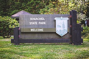
Bogachiel State Park is a 127-acre (51 ha) public recreation area on the Bogachiel River four miles (6.4 km) south of the city of Forks on Highway 101 in Clallam County, Washington. The state park was established in 1931, with initial management and development performed under the auspices of the Bogachiel Improvement Club and Forks Chamber of Commerce.[2] State staffing began in 1961.[3] The park has facilities for picnicking, camping, and hiking.[2][4][5]
- ^ a b "Bogachiel State Park". Geographic Names Information System. United States Geological Survey, United States Department of the Interior.
- ^ a b Cite error: The named reference
waspwas invoked but never defined (see the help page). - ^ Cite error: The named reference
wasparchivewas invoked but never defined (see the help page). - ^ Cite error: The named reference
Seattle Times June 30, 1996was invoked but never defined (see the help page). - ^ Cite error: The named reference
Seattle Times January 14, 1999was invoked but never defined (see the help page).

