Bohicon
Gbɔ̀xikɔn | |
|---|---|
Road leading into Bohicon from the south | |
| Coordinates: 7°12′N 2°04′E / 7.200°N 2.067°E | |
| Country | |
| Department | Zou Department |
| Area | |
| • Total | 44 km2 (17 sq mi) |
| Elevation | 167 m (548 ft) |
| Population (2012) | |
| • Total | 149,271 |
| • Density | 3,400/km2 (8,800/sq mi) |
| Time zone | UTC+1 (WAT) |
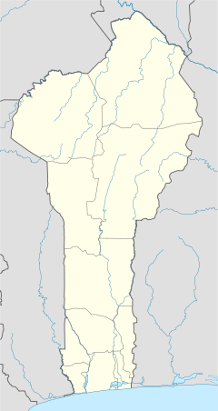
Bohicon [bɔ.i.kɔ̃] or Gbɔ̀xikɔn [gbɔ.i.kɔ̃] is a city in Benin, and a conurbation of Abomey lying 9 kilometres east of the city on the railway line from Cotonou to Parakou and on Benin's main highway RNIE 2 which joins the RNIE 4. The commune covers an area of 139 square kilometres and as of 2012 had a population of 149,271 people.[1][2]


A speciality sold in the market is afitin (soy dawa-dawa/soy iru), which is traditionally and somewhat famously in Benin made by women in the region. It is a protein-rich fermented food widely used in West Africa as a seasoning.
- ^ "Bohicon". Atlas Monographique des Communes du Bénin. Retrieved January 5, 2010.
- ^ "Communes of Benin". Statoids. Archived from the original on March 24, 2012. Retrieved January 5, 2010.
