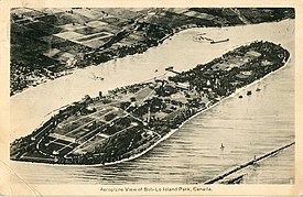
Nickname: Boblo Island | |
|---|---|
 Aerial view of Boblo Island (1941) | |
| Geography | |
| Location | Detroit River |
| Coordinates | 42°05′44″N 83°07′14″W / 42.09556°N 83.12056°W |
| Area | 1.10 km2 (0.42 sq mi) |
| Administration | |
Canada | |
| Province | Ontario |
| County | Essex |
| City | Amherstburg |
| Additional information | |
| Time zone | |
| • Summer (DST) | |
Bois Blanc Island, commonly referred to as Boblo Island, is an island in the Detroit River on the Canadian side of the border and is part of Amherstburg, Ontario. The island is about 4.0 kilometres (2.5 mi) long, 0.80 km (0.5 mi) wide and 110 hectares (272 acres) in size.
The main northbound shipping channel of the Detroit River currently lies between Boblo Island and the Amherstburg mainland. A stone lighthouse was built in 1836 on the southern tip of Boblo Island which marks the historical beginning of the Detroit River navigation channel for ships travelling upriver from Lake Erie in more modern times. It is now part of the Bois Blanc Island Lighthouse and Blockhouse.

