| Bolton Notch State Park | |
|---|---|
| Saqumsketuck | |
 Drawing of Squaw's Cave of Bolton Notch State Park from the book The Story of Wunnee-Neetunah, or The Life of an Indian Princess of Connecticut by Mathia Spiess c. 1934 | |
| Type | Protected area |
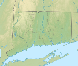
| Location | Bolton, Connecticut, United States |
| Nearest city | Hartford, Connecticut |
| Coordinates | 41°47′20″N 72°27′11″W / 41.78889°N 72.45306°W[1] |
| Area | 95[2] |
| Elevation | 568 ft (173 m)[1] |
| Established | 1918 |
| Etymology | A land or place of hard rock (Saqumsketuck) |
| Administered by | Connecticut Department of Energy and Environmental Protection |
| Open | Dusk to dawn |
| Status | Open all year |
| Hiking trails |
|
| Terrain | Forested |
| Water | Salmon River |
| Designation | Connecticut state park |
| Parking | Free |
| Website | Official website |
Bolton Notch State Park is a public, protected recreation area located at the junction of U.S. Route 44 and U.S. Route 6 in the town of Bolton, Connecticut. The site forms part of the boundary between the Thames River and Connecticut River watersheds.[3] The state park's 95 acres (38 ha) offer opportunities for hiking, climbing, and cave exploration.[4]
- ^ a b Cite error: The named reference
gniswas invoked but never defined (see the help page). - ^ Cite error: The named reference
pristaffwas invoked but never defined (see the help page). - ^ Cite error: The named reference
watershedwas invoked but never defined (see the help page). - ^ Cite error: The named reference
DEEPwas invoked but never defined (see the help page).

